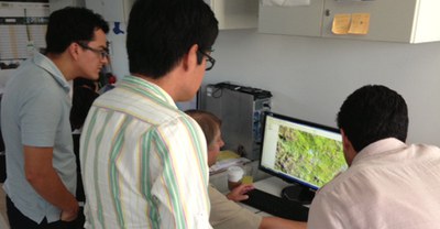
FCMC continues support to Peru's forest monitoring system

The trip to Peru also presented an opportunity for FCMC, SilvaCarbon, and UMD to provide USAID mission staff with an overview of ongoing activities, including UMD’s recently released global forest mapping product that was developed in partnership with Google. The meetings also included a discussion on possible contributions from SilvaCarbon and FCMC on MRV capacity in the Andean region at the upcoming United Nations Framework Convention on Climate Change Conference of Parties (UNFCCC COP), which will be held in Lima in November.
In January 2013, FCMC launched an activity to support the development of Peru’s forest monitoring system. This activity facilitates the development of wall-to-wall national forest cover and deforestation data and includes a series of regional capacity building workshops in support of a national forest monitoring MRV system for Peru. The project will continue through late 2014. UMD previously installed their forest cover and deforestation monitoring system at MINAM in November 2012. UMD and CI, both FCMC partners, have provided ongoing technical capacity-building support to MINAM’s analysts.
During the March meetings, FCMC helped refine agendas and topics for the regional capacity building workshops. In collaboration with MINAM, FCMC plans to hold a series of workshops between June and November 2014 that will increase capacity within regional governments and institutions on a number of MRV concepts, including: image interpretation skills to support multiple activities (validation verification of generated products based on regional expertise, etc.); classification methodologies; validation techniques; and near-real time monitoring options. These topics are important in Peru because of Peru’s decentralized governmental structure and the need to determine appropriate roles of regional governments within a national MRV system. The workshops will include attendees from four yet to be determined regional governments, possibly including San Martin, with the goal to build capacity so they can contribute to the forest monitoring system (via image interpretation during the classification process or contributing to the validation process). Thus, the workshops will cover remote sensing fundamentals, interpretation of optical satellite imagery with a focus on forest change, and a review of validation approaches, including sampling and validation statistics.

